Systemic Vulnerabilities and Emergency Management Dynamics
The eastward propagation of a robust baroclinic system across the Southeastern United States has catalyzed a series of high-intensity convective events, requiring complex multi-agency coordination. In Mississippi, the issuance of rare ‘tornado emergencies’ for Lincoln, Lamar, Franklin, and Kemper counties underscores an immediate threat to life and structural integrity. This classification indicates a high level of confidence in a damaging tornado touching down in populated areas.
The resulting degradation of residential housing stocks and the failure of utility distribution networks—primarily through downed high-voltage lines—present significant operational bottlenecks for recovery teams. Damage assessments are prioritized to quantify the impact on critical transport corridors, where debris clearance is a prerequisite for restoring essential services and supply chain continuity.
The actuarial implications for the regional insurance sector are substantial. The convergence of structural collapses and widespread vehicle damage is expected to drive a surge in high-priority claims. This meteorological transition, which originated as a snow-producing system in the Rockies, demonstrates the volatile nature of cross-continental weather patterns as they interact with Gulf moisture.
Tactical Response Constraints in the Florida Panhandle
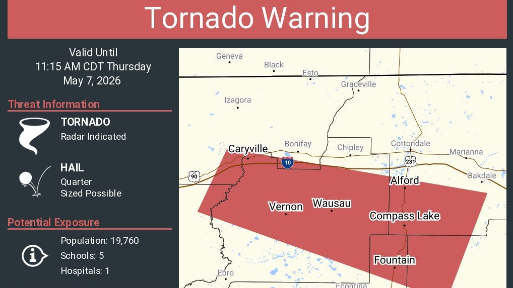
In the Florida Panhandle, tornado warnings for Bay, Calhoun, Holmes, Jackson, Walton, and Washington counties highlight a rapidly evolving tactical environment. The National Weather Service (NWS) has utilized radar-indicated rotation to trigger immediate sheltering protocols in Vernon, Alford, and Caryville. The storm front’s propagation velocity—exceeding 50 mph—severely compresses the decision-making window for public safety alerts.
Atmospheric instability has produced wind gusts up to 70 mph, threatening the stability of the regional power grid and telecommunications infrastructure in the Big Bend. Furthermore, the presence of golf-ball-sized hail introduces a secondary risk layer, threatening agricultural yields and the integrity of commercial roofing systems across affected jurisdictions.
Strategic Alerting and Urban Operational Continuity
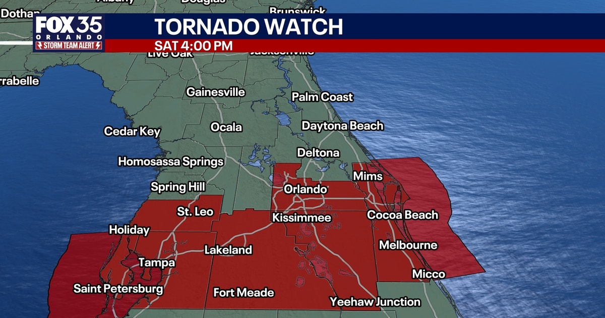
Central Florida has implemented heightened vigilance protocols, with ‘Storm Alert Day’ designations facilitating pre-emptive safety measures. Tornado watches encompassing up to 20 counties, including the high-density hubs of Orange, Osceola, and Hillsborough, reflect a broad geographic exposure to severe weather. The temporal distribution of the threat—stretching from late morning in Ocala to evening in Cocoa Beach—allows for a staggered logistical response regarding school dismissals and commercial shift rotations.
While convective intensity typically wanes post-sundown, the initial hydraulic load from heavy precipitation remains a primary concern for municipal drainage systems. The transition from record-level thermal energy (near 90 degrees) to a post-frontal environment sustains the turbulence necessary for severe weather through the evening transition.
Institutional Recovery and Long-term Infrastructure Resilience
Restoration efforts for utility providers are currently hampered by the ‘sequential dependency’ of disaster recovery; specialized debris removal must precede the deployment of heavy repair equipment to saturated terrain. This logistical lag extends the duration of service interruptions for affected populations, testing the limits of local mutual aid agreements.
The economic impact extends to the service and tourism sectors in Orlando and Tampa, where severe weather disrupts transport hubs like Orlando International Airport and necessitates the cancellation of outdoor commercial events. Long-term, the destruction in Mississippi will serve as a critical data point for engineers and policymakers evaluating the resilience of residential building codes against high-velocity convective winds.