
Synoptic Steering and Structural Dynamics
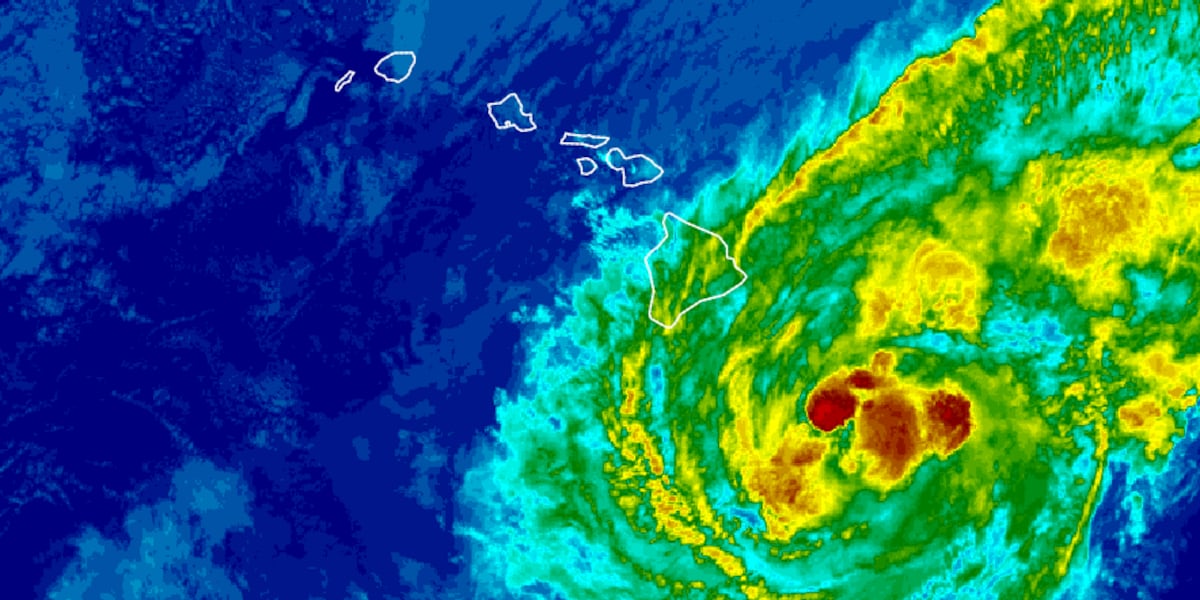
Tropical Storm Lala is tracking west-northwest at 12 to 13 mph, centered approximately 165 miles east-southeast of South Point, Hawaii Island. Maximum sustained winds are near 65 mph with higher gusts. The Central Pacific Hurricane Center (CPHC) reports organized deep convection near the low-level circulation center, supporting intensification into a Category 1 hurricane prior to its closest approach to Hawaii Island on Saturday morning.
A persistent mid-tropospheric subtropical ridge anchored north of the Hawaiian archipelago governs the primary steering flow. Lala’s wind field remains asymmetric and expansive: tropical-storm-force winds extend outward up to 220 miles from the center, initiating coastal gale conditions, squalls, and rough surf across eastern exposures well ahead of the core’s arrival.
Topographic Modification and Kinematic Disruption
Forecast models project the vortex to pass near or over southern Hawaii Island. Direct interaction with the island’s volcanic terrain will trigger low-level structural disruption, frictional deceleration, and track deviations. In the immediate lee of the landmass, weakened steering currents may induce a brief northwestward deflection before the cyclone resumes a west-northwestward trajectory.
As the system moves south of the smaller islands later this weekend, thermodynamic and kinematic conditions will degrade. Increasing southwesterly vertical wind shear, combined with post-landfall core disruption, will force a steady weakening trend. However, localized wind hazards will amplify due to complex topography: orographic forcing and venturi effects through mountain gaps and elevated ridges will produce localized wind gusts up to 30 percent higher than ambient marine-level sustained wind values.
Hazard Stratification and Interagency Preparations
Emergency management agencies have aligned defensive protocols according to regional exposure risks:
- Hawaii Island: Hurricane Warning, Flood Watch, and High Surf Warning in effect. Severe wind damage, life-threatening surf, and localized flash flooding are the primary threats.
- Maui County: Onset of tropical-storm-force conditions projected for Saturday night, with orographic precipitation totals estimated between 8 and 12 inches across windward slopes.
- Oahu and Kauai: Peripheral tropical storm impacts possible by Sunday morning as the decaying cyclone tracks through the southern offshore waters.
Hydrological concerns remain acute along steep watersheds, where excessive rain rates risk overwhelming drainage channels and compromising civil infrastructure through debris flows and rapid runoff.
Photo by PublicDomainPictures on Pixabay.