The National Weather Service (NWS) escalated emergency alert thresholds across the Central Plains and South Central corridors, issuing an observed tornado warning for Crosby and Dickens Counties in Texas alongside a convective severe weather framework across the Kansas City metropolitan area. The formal designation of an "observed" tornado alters standard hazard mitigation protocols, shifting response mechanisms from probabilistic modeling to real-time defensive posture. Concurrently, rapid thermal collapse following near-record 90-degree temperatures in Missouri underscores severe convective instability across multiple regional economic nodes.
Tactical Response and Kinetic Lead Time in West Texas
The operational profile of the Dickens County tornadic cell illustrates severe compression of institutional response windows. Propelled northeastward at 35 mph, the system generated an emergency broadcast at 6:16 PM with projected terminal impact in Dickens by 6:20 PM. This four-minute lead time largely precludes dynamic evacuations, rendering life-safety outcomes almost entirely contingent upon pre-existing structural sheltering.
NWS risk matrices explicitly categorized mobile and manufactured housing as non-resilient assets facing imminent destruction. Concurrently, the inclusion of two-inch hail threats expands the loss profile from isolated structural failure to widespread capital depreciation. Two-inch hail significantly exceeds typical impact-resistance thresholds for commercial vehicle fleets, residential building envelopes, and agricultural assets, guaranteeing immediate spikes in comprehensive property casualty claims across Crosby and Dickens Counties.
Metropolitan Instability and Hydrological Exposure in Kansas City
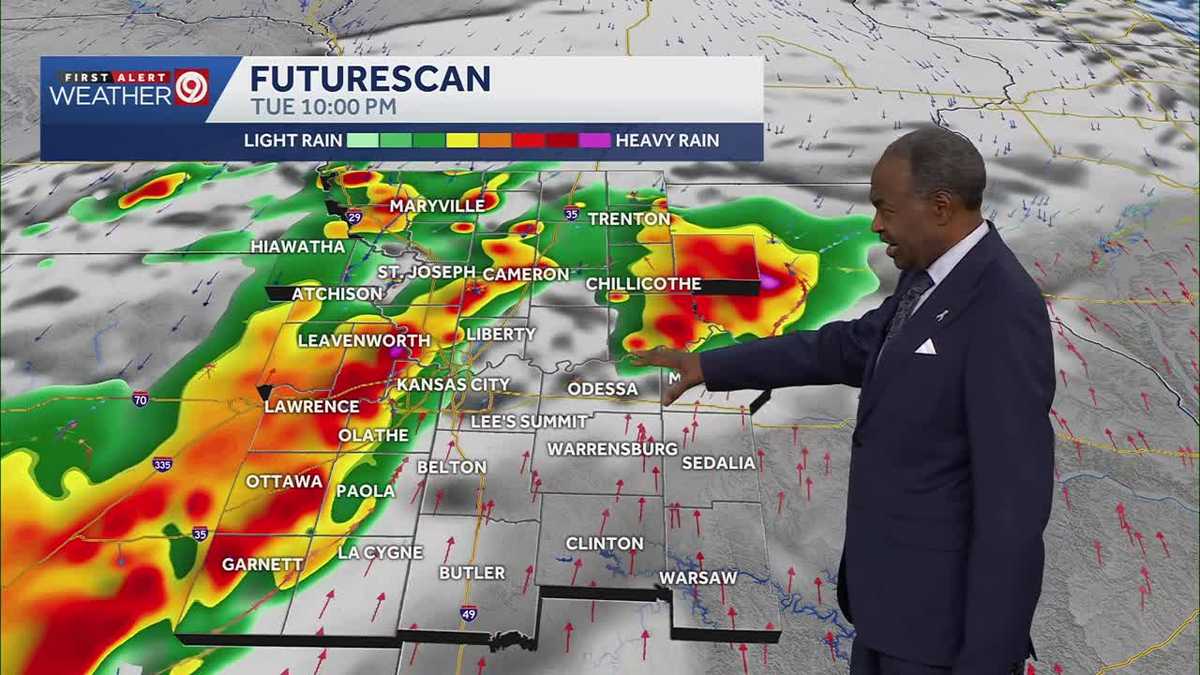
In the Kansas City metropolitan area, the thermodynamic transition from near-record 90-degree surface heat to supercell convection triggered a severe thunderstorm watch through 11:00 PM Tuesday. The integration of media and municipal "First Alert Weather Day" frameworks functioned as preemptive risk mitigation, designed to suppress commuter density during peak evening operational windows.
The secondary risk layer shifts from aerodynamic force to hydrological saturation. A flash flood watch operative from 7:00 PM Tuesday into Wednesday morning addresses rapid precipitation over thermally hardened soils. Because urban drainage infrastructure faces saturation thresholds during intense convective downpours, residual runoff creates arterial road hazards that threaten Wednesday morning freight and commuter corridors.
Multi-Day Logistical and Economic Disruption
The structural impact of the weather pattern extends beyond Tuesday's acute warnings. With First Alert Weather Impact Days prolonged into Wednesday and Thursday, prolonged precipitation cycles limit infrastructural drying time and prolong operational inefficiencies across regional supply chains.
- Ground and Freight Logistics: Rapid-onset storm corridors along Texas transit arteries enforce rerouting, speed restrictions, and asset staging delays.
- Insurance and Balance-Sheet Drag: High-energy hail in Texas alongside urban water ingress in Missouri present compounding microeconomic claims across agricultural and metropolitan property sectors.
- Alert Architecture Reliability: The execution of high-tier urgency tags demonstrates the necessity of automated override triggers in telecommunications, mitigating alert fatigue while enforcing compliance during ultra-short warning cycles.