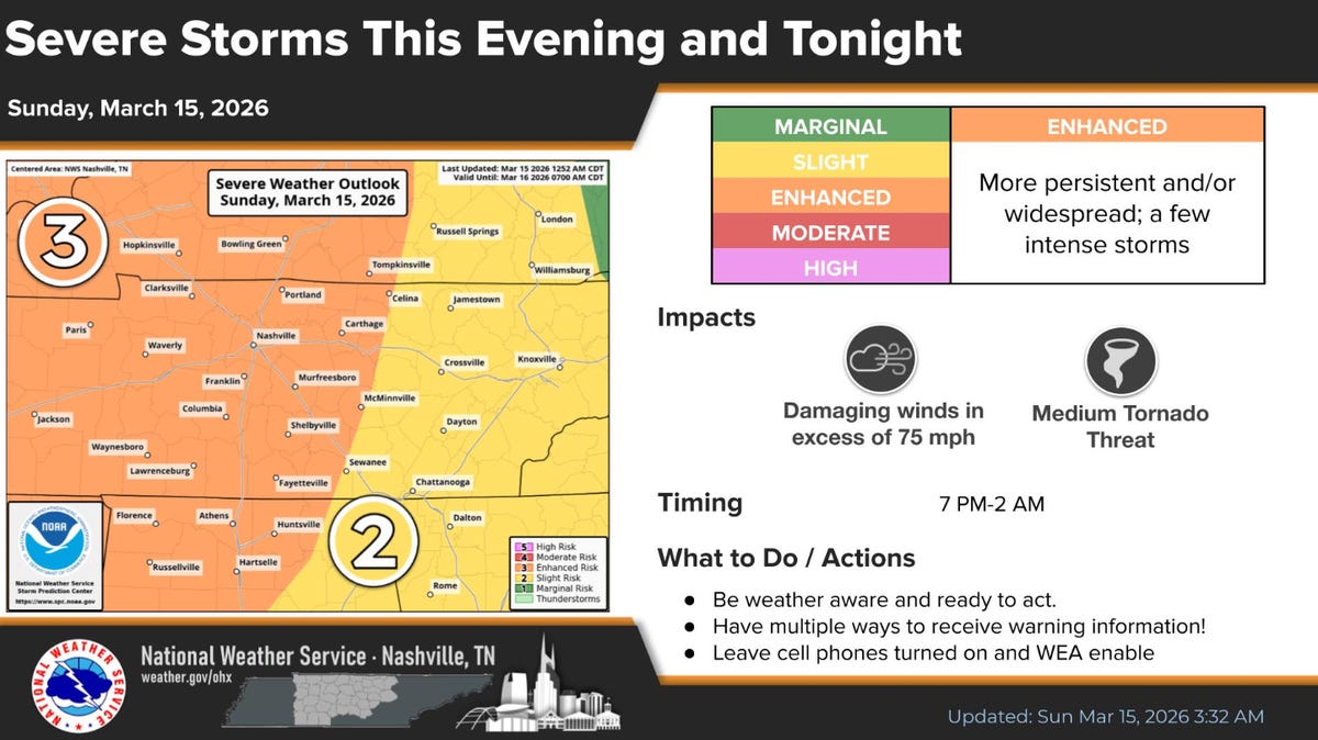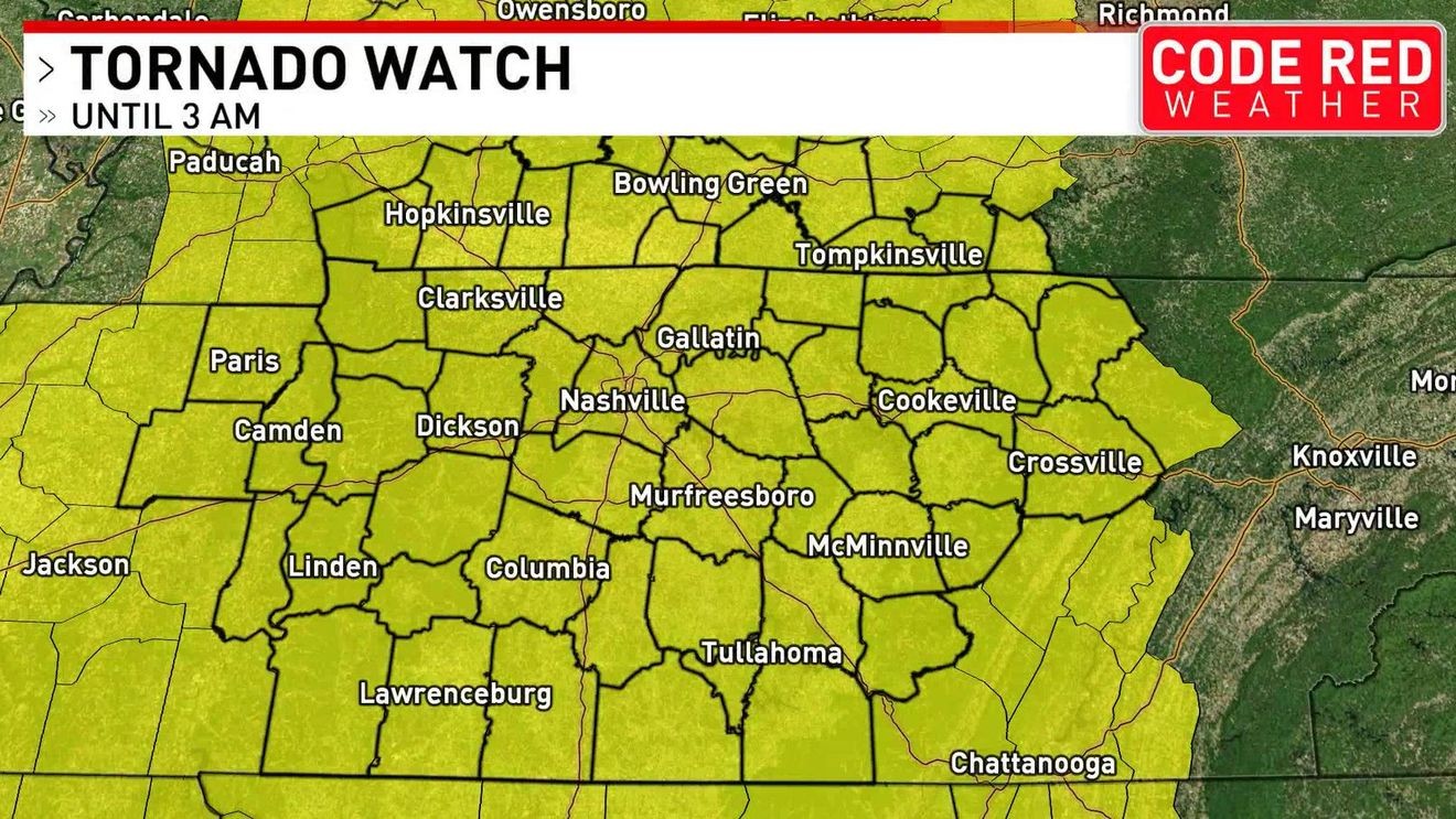
A potent, fast-moving storm complex has initiated significant operational constraints across Middle Tennessee and Southern Kentucky, evidenced by a Tornado Watch effective until approximately 3 a.m. Monday across the core area.
Hazard Analysis: Confluence of Wind and Rotation
The threat matrix has escalated beyond generalized advisories, highlighting a distinct risk of high-impact rotational wind events, specifically tornadoes, alongside non-rotational gusts projected near 75 mph. This acute, short-duration severe profile necessitates immediate recalibration of resource allocation for Emergency Management Agencies (EMAs).
The critical deployment window for assets is projected immediately following the main storm line passage, anticipated between 8 p.m. and 12 a.m. for western sectors (west of I-65). Furthermore, a baseline environmental stressor exists via a concurrent Wind Advisory (until 7 a.m. March 16) forecasting sustained 15-25 mph southerly winds with gusts up to 45 mph, amplifying general infrastructure vulnerability.
Infrastructure Resilience and Post-Event Logistical Strain
Sustained high winds critically increase the probability of power distribution failure and localized transportation blockages, compelling utility providers to enact advanced staffing augmentation protocols. A unique logistical complication arises from the rapid post-frontal thermal inversion; temperatures are forecast to plunge into the low 30s, potentially introducing light snow showers and grassy frost by Monday morning.
This swift transition from severe convection to freezing conditions demands integrated inter-agency planning between weather response teams and public works to address immediate slick infrastructure post-event, requiring a multi-dimensional response strategy.
Geospatial Timing and Governance Decision Cycles
The National Weather Service’s sequencing—tracking the storm line from the Mississippi River eastward—establishes a definitive decision-making timeline for regional governance. For core metropolitan areas like Nashville within the Watch zone, this timing directly intersects with evening commercial activity and peak first responder shift changes.
The strategy for local government must optimize public compliance with immediate shelter directives while ensuring continuity of critical infrastructure monitoring overnight. Given the expected short duration of the severe phase, strategic focus shifts from mass evacuation to swift post-event damage assessment.
Economic Friction and Supply Chain Vulnerability
Businesses operating within the affected corridor face immediate continuity decisions regarding asset security and workforce safety, particularly concerning disruptions aligning with the 8 p.m. to midnight danger window. Sectors dependent on precise JIT logistics or cold chain management are highly exposed to supply chain breaks from temporary road closures.
The subsequent economic drag from Monday morning’s cold snap and potential minor snow accumulation threatens commute efficiency and delays the normalization of commercial operations following overnight stand-downs.
Risk Modeling and Insurance Implications
For the property and casualty sector, the sequence of high wind/tornado risk followed by rapid freezing conditions creates a complex claims landscape. Risk modeling for this region must now explicitly incorporate the interaction between wind-induced structural stress and subsequent icing, which can compound damage profiles.
Commercial real estate and agricultural stakeholders must quantify the short-term operational stoppage against the projected long-term maintenance exposure stemming from standardized 75 mph wind events.
Information Velocity and Warning System Efficacy
The layered alert structure (Wind Advisory $
ightarrow$ Tornado Watch $
ightarrow$ Post-Event Cold Forecast) places extreme pressure on local media to sequence information coherently. The documented reliance on digital platforms, such as NWS social media updates, underscores the necessity of resilient digital communication infrastructure for time-critical hazard alerts.
The efficacy of the warning system hinges on public trust during rapid threat escalation. The brief nature of the event demands maximized attention capture within a constrained time frame, contrasting sharply with lengthy, slow-developing weather systems.
Transition to Normalization Under Colder Conditions
Post-passage, operational focus pivots immediately to system normalization under significantly colder parameters. The rapid temperature drop initiates the next logistical phase: assessing infrastructure integrity and restoring transportation flow while personnel contend with near-freezing ambient conditions.
This sharp transition validates the need for pre-established inter-agency protocols for damage assessment that mandate appropriate gear and strategy adjustments for cold-weather recovery operations.