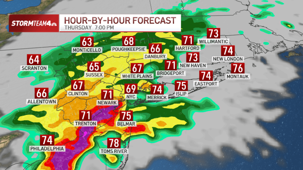
The convergence of high-intensity precipitation and atmospheric instability on Thursday evening functioned as a significant stress test for the Tri-State area’s regional infrastructure. National Weather Service alerts—varying from acute tornado warnings in Nassau County to sustained flash flood warnings in New York City—exposed the operational vulnerabilities of high-density transit corridors. The timing of these events, intersecting with peak evening mobility, introduced significant systemic friction into transportation and logistics networks.
Institutional Risk and Warning Lifecycles
The issuance of short-fused Tornado Warnings for Nassau and Queens underscores the necessity of institutional agility in emergency management. These alerts demand immediate tactical shifts in public safety protocols, requiring agencies to manage the lifecycle of a warning that transitions rapidly from wind-based threats to hydrological risks. The expiration of specific warnings does not signal an end to operational hazards; rather, it shifts the focus to lingering threats such as structural integrity and cascading delays within the urban grid.
In New Jersey, the activation of protocols across ten counties indicates broad geographic exposure. The sequential nature of these warnings—starting in South Jersey and progressing northward—allows for a tiered emergency response but places a sustained burden on regional monitoring systems. This temporal progression tracks a storm front that necessitates constant data recalibration for transit authorities and public works departments.
Hydrological Thresholds and Built Environment Capacity
Forecasted accumulations of 3 to 4 inches of rain present a direct challenge to the drainage capacity of legacy sewer systems. In urban centers like New York City, flash flooding occurs when precipitation rates exceed the discharge specifications of the subterranean infrastructure. This overflow creates immediate hazards for low-lying transit routes and subterranean utility networks, necessitating a shift from reactive monitoring to targeted intervention in high-risk zones.
Saturated soil conditions in South Jersey, resulting from early-evening rainfall of 1 to 3 inches, have significantly increased the runoff coefficient. This saturation reduces the landscape’s natural absorption capacity, accelerating the onset of flash flooding in counties such as Atlantic and Cumberland. For local governments, this narrow window for preventative measures emphasizes the critical need for real-time situational awareness and rapid resource deployment to maintain service continuity.
Economic Friction and Logistics Volatility
Hazardous travel conditions introduce measurable economic friction by disrupting the efficiency of the regional marketplace. Slowed transit times directly impact labor productivity and the reliability of last-mile delivery services. For corporate entities operating under just-in-time logistics frameworks, weather-induced delays ripple through the supply chain, affecting inventory management and operational overhead.
The potential for damaging winds introduces a layer of property risk that requires sophisticated insurance and asset management strategies. Commercial facilities within the storm’s path must account for structural vulnerabilities, while real-time radar data from providers like NBC 4 and WABC becomes a vital tool for business continuity planning. This data-driven approach to environmental risk allows for informed decision-making regarding site closures and the protection of high-value assets during periods of acute volatility.