Operational Escalation and WUI Dynamics
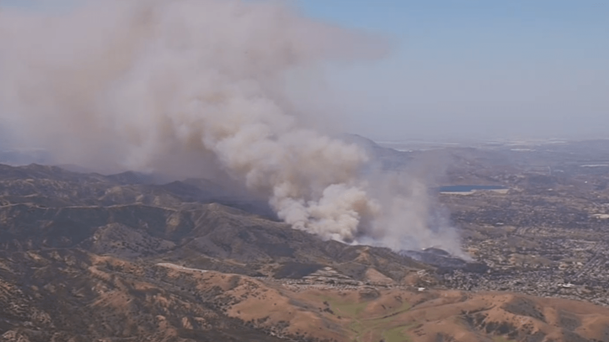
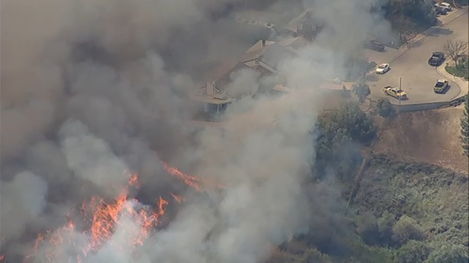
The Sandy Fire, originating in the 600 block of Sandy Drive on May 18, serves as a quintessential case study in Urban-Wildland Interface (WUI) risk management. The incident’s rapid expansion from an incipient one-acre spot to a ten-acre conflagration necessitated an immediate transition to a second-alarm response. This strategic surge enabled the Ventura County Fire Department (VCFD) to deploy a concentrated mix of engine companies, hand crews, and heavy machinery, including dozers, to establish a defensive perimeter against aggressive fuel loads.
The integration of the AIR7 surveillance platform was pivotal for real-time intelligence gathering. Aerial coordination provided ground commanders with the situational awareness required to manage a multi-dimensional attack, particularly when fire behavior suggested a high probability of structural impingement.
Geospatial Analysis of Evacuation Frameworks
The activation of evacuation zones 32-35 utilized a strategic containment philosophy based on existing infrastructure and topographic barriers. By establishing Royal Avenue and Madera Road as northern and western boundaries, authorities leveraged established fire breaks to minimize civilian exposure. The reliance on Edison Road and the Albertson Fire Road for eastern and southern markers facilitated the deployment of heavy assets without obstructing resident egress.
Furthermore, the issuance of an evacuation warning for Zone 31—positioned south of Madera Road—demonstrated proactive risk mitigation. This tiered approach accounted for potential ‘spotting’ or erratic wind shifts common in the Simi Valley terrain, ensuring that populations near the Bard Reservoir remained in a state of high readiness.
Meteorological Drivers and Fire Velocity
The primary catalyst for the fire’s rapid rate of spread (ROS) was a localized wind advisory effective until 15:00 hours. In canyon-adjacent topographies, wind-driven fires exhibit non-linear behavior, often rendering traditional hand-cut lines obsolete. The transition to ten acres within a condensed timeframe underscores the relationship between atmospheric pressure gradients and fuel moisture depletion.
As fire intensity increased, topographic features likely induced a ‘chimney effect’ near the 600 block of Sandy Drive, accelerating the upward trajectory of heat and embers. This necessitated a heavy reliance on aerial water and retardant drops to dampen the fire’s head while ground crews focused on structural hardening.
Structural Defense and Institutional Resilience
With at least two residential structures identified as involved, operational focus shifted to active asset protection. This transition highlights the persistent vulnerability of homes situated on canyon rims. The use of vcemergency.com as a centralized data hub reflects the modernization of public safety communications, providing a single source of truth that reduces the latency inherent in traditional emergency broadcast systems.
The Sandy Fire emphasizes that suppression alone is insufficient; long-term resilience depends on the enforcement of defensible space regulations and the institutionalization of rapid-response mutual aid agreements. The successful containment of the blaze, despite structural losses, validates the efficacy of second-alarm resource allocation in preventing a larger catastrophic event.