Strategic Framework of the NWS Tornado Watch
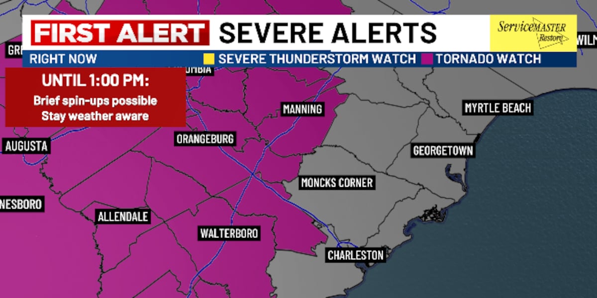
The National Weather Service (NWS) issuance of a tornado watch across South Carolina serves as a critical lead-time instrument, providing a four-to-eight-hour window for systemic mobilization. Unlike a warning—which signals immediate tactical action—the watch serves as a strategic threshold for institutional stakeholders to activate emergency protocols and mitigate potential liability. This temporal buffer is essential for utility providers and emergency services to optimize resource positioning before atmospheric instability peaks.
Regional Logistics and Morning Transit Friction
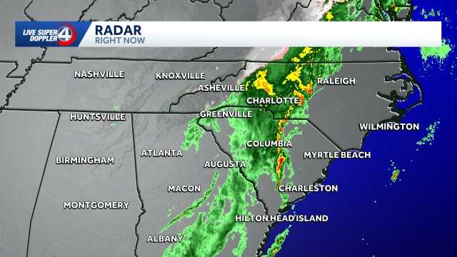
The Upstate region, encompassing Abbeville, Laurens, Union, and Greenwood counties, faces a high-consequence risk window between 6:00 a.m. and 11:00 a.m. This timing creates significant friction for morning transit and commercial logistics. The development of a secondary storm line coincides with peak traffic volumes, increasing the exposure of the transportation sector to high-wind events and sudden visibility degradation. Logistics managers must balance the threat of localized ‘spin-up’ tornadoes against the economic necessity of maintaining interstate supply chain continuity.
Coastal Exposure and Maritime Operational Sensitivity
The expansion of the watch to the Lowcountry—including Beaufort, Colleton, Dorchester, and Orangeburg—highlights the geographical reach of this cold front. Coastal regions experience unique atmospheric forcing as the front interacts with maritime air, potentially intensifying hail and wind shear. For port operations and maritime industry players, the 1:00 p.m. expiration window necessitates strict monitoring of wind-sensitive equipment and vessel positioning to prevent catastrophic structural failures.
Thermal Volatility and Utility Load Management
The projected ‘roller-coaster’ thermal profile—transitioning from the 70s to the 30s by Friday morning—represents a significant stress test for the state’s energy infrastructure. This rapid cooling drives sudden spikes in heating demand, requiring precision in load distribution to maintain grid stability. Simultaneously, the agricultural sector faces immediate financial exposure as crops acclimated to unseasonably warm conditions are subjected to near-freezing temperatures, potentially impacting long-term yields in the Midlands and Upstate.
Institutional Readiness and Digital Risk Communication
Modern risk mitigation relies on the granular dissemination of real-time data through platforms like the Live 5 First Alert Weather App. This technological integration allows for a decentralized yet coordinated response, enabling private and public sectors to distinguish between preparatory and action-oriented phases. As the system moves toward the coast, the efficacy of this digital communication remains the primary variable in reducing operational downtime and ensuring workforce safety during peak atmospheric volatility.
Conclusion: Diagnostic of Regional Resilience
This weather event serves as a diagnostic of South Carolina’s infrastructure resilience. Beyond the immediate threat of tornadic activity, the state must manage the secondary effects of saturated soils, potential power outages, and rapid temperature fluctuations. The ability of emergency management frameworks to absorb these multi-hazard impacts provides a benchmark for long-term regional disaster preparedness and economic continuity.