Hurricane Polo’s Rapid Intensification and Pacific Basin Activity
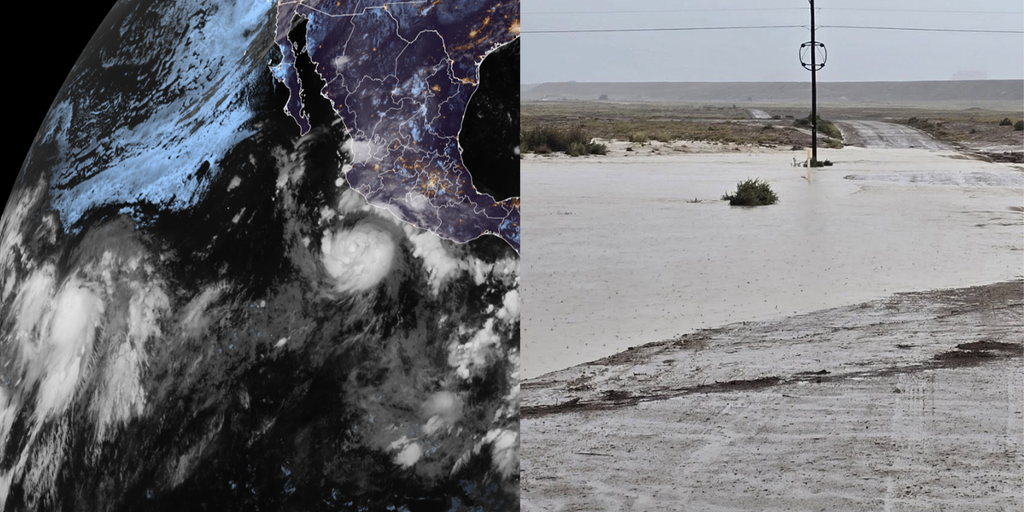
Tropical Storm Polo rapidly intensified into a Category 1 hurricane over the Pacific Ocean on Monday afternoon and is forecast to become a major hurricane by Tuesday. This intensification signals elevated hazards for maritime and inland zones. The development occurs amidst a highly active Pacific basin, with forecasters monitoring four distinct tropical systems, straining monitoring resources and requiring dynamic deployment.
Polo’s swift transition from tropical storm to hurricane is attributed to exceptionally warm sea surface temperatures and favorable upper-level atmospheric conditions, hallmarks of the current El Niño pattern. The storm’s projected trajectory will draw significant moisture northward, interacting with regional atmospheric patterns and extending moisture transport far beyond the cyclone’s immediate vicinity. This scenario necessitates urgent activation of emergency mitigation measures by civil protection agencies, municipal planners, and water management authorities.
El Niño: The Macro-Climatic Driver of Enhanced Pacific Cyclogenesis
Hurricane Polo’s rapid intensification is a direct consequence of a robust El Niño phenomenon. This climate pattern disrupts typical Pacific equatorial wind regimes, concentrating warm ocean waters and weakening wind shear—conditions conducive to rapid storm development. The Eastern and Central Pacific basins have already produced eighteen named storms this season, significantly surpassing historical averages with over two months remaining.
This elevated rate of cyclogenesis indicates substantial atmospheric energy reservoirs. The compounding effect of multiple, persistent tropical systems places continuous strain on institutional response mechanisms. Emergency response networks face reduced maintenance windows between events, while municipal infrastructure endures prolonged moisture loading. The El Niño cycle necessitates a strategic shift from individual storm responses to sustained, long-duration readiness against cyclical, basin-wide disruptions.
Hydrological Vulnerability Across the American Southwest
Although Hurricane Polo’s center is expected to remain offshore, its expansive wind field and associated tropical plume will introduce significant moisture into the American Southwest. High-volume moisture advection beginning Tuesday is forecast to generate serious flood threats across inland areas, with New Mexico identified as a primary focal area. Deep subtropical moisture plumes frequently trigger hazardous runoff when intersecting continental landmasses.
Arid and semi-arid terrains are particularly vulnerable to sudden, intense rainfall. The low infiltration rates of dry Southwestern soils convert precipitation into high-velocity runoff rapidly. Flash flood watches and urban drainage warnings are critical intervention points for municipal authorities tasked with safeguarding transportation networks and populated valleys. The systemic risk of widespread flash flooding demands early, decisive allocation of rescue resources and continuous monitoring of hydrological gauges.
Southern California: Uncharacteristic Humidity and Coastal Precautions
Southern California is experiencing a trend toward unusually humid conditions as the system’s moisture boundary expands northward. Peripheral weather effects are not anticipated until the late weekend at the earliest, providing an actionable preparation window. However, the impending tropical humidity presents operational challenges for energy consumption, regional air quality, and local drainage operations.
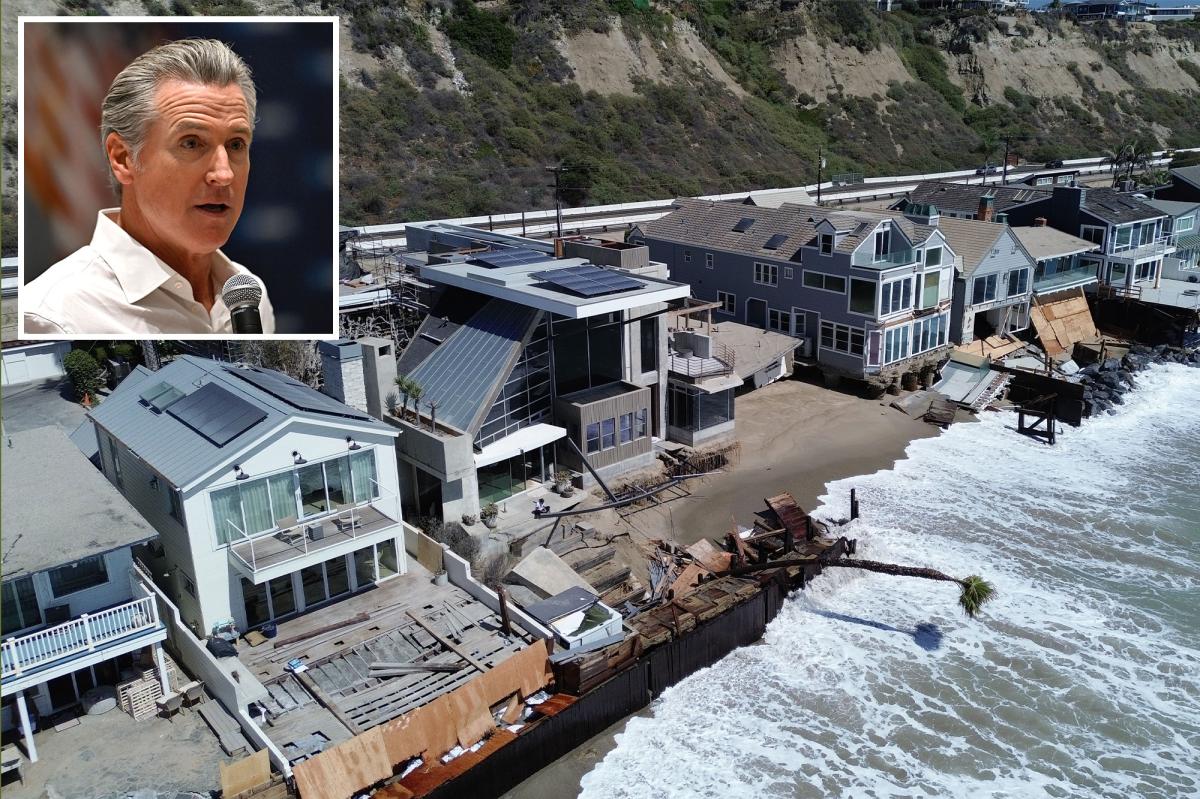
This environmental shift follows closely after Hurricane Marie impacted the Southern California coastline with structural coastal flooding and aggressive tidal surges. Residual damage to marine defenses, destabilized coastal berms, and degraded seawall structures necessitate verification of coastal asset integrity prior to any secondary surf or rain events. The recurrence of late-season Pacific systems altering local atmospheric norms tests institutional resilience, increasing electrical grid demand and requiring clear storm channels to prevent flash inundation.
The Insular Crisis: Tropical Depression Fifteen-E and Hawaii’s Exposure
Beyond Hurricane Polo, the National Hurricane Center monitors the remnants of Tropical Depression Fifteen-E, which may redevelop and direct heavy precipitation toward Hawaii. As Hawaii rarely experiences direct tropical storm activity, its infrastructure and logistical lifelines face unique exposure to uncharacteristic rainfall. The geographical isolation of an archipelago complicates disaster recovery logistics and supply chain reinforcement, relying on vulnerable maritime ports and runways.
Heavy rainfall over steep volcanic terrain can accelerate localized landslides, isolating settlements and severing transportation arteries. Hawaii’s storm drainage infrastructure, designed for historical precipitation metrics, faces elevated stress under active El Niño regimes. Redeveloping tropical disturbances can deposit extreme water volumes over confined basins. The intersection of rare tropical activity and limited local storage highlights the fragility of isolated island infrastructure during hyperactive Pacific seasons.
Transnational Exposure: Mexico’s Coastal and Inland Hazard Profile
Hurricane Polo’s proximity to the Mexican coastline poses significant strategic and physical risks. Rapid intensification near the mainland endangers commercial shipping, offshore assets, and coastal settlements. Associated precipitation bands can trigger severe inland flash flooding and extensive mountain landslides across complex topographies. The geomorphology of western Mexico, featuring steep gradients near warm coastal waters, intensifies orographic lift upon system approach.
Massive tropical plumes impacting these mountain barriers multiply rainfall intensity, transforming riverbeds into destructive torrents. Civil protection agencies face urgent demands for preemptive evacuations in vulnerable hillside settlements. Institutional challenges in issuing rapid warnings across rural communities, mandatory port closures suspending fishing and trade, and landslide-blocked highways threatening isolation underscore the need for decentralized resource stockpiling and robust cross-border coordination.
Institutional Coordination and Meteorological Surveillance Demands
The tracking of four concurrent tropical systems across the Pacific highlights the immense analytical burden on international forecasting agencies like the National Hurricane Center. Continuous generation of predictive models, trajectory matrices, and intensity curves is vital for formulating emergency declarations. Accurate probabilistic forecasting enables emergency services to deploy swift-water rescue teams, open shelters, and position mobile generators before landfall impacts materialize.
Communication channels between federal weather entities and municipal leadership are the primary safeguard against catastrophic failures. In cases of rapid intensification, warning thresholds must be updated dynamically to prevent civic complacency. When storms rapidly transition to major hurricane status, static response manuals fail, demanding dynamic command structures capable of revising threat parameters in real time. Cross-border collaboration between US and Mexican meteorological organizations ensures consistent threat assessments, reducing mixed public messaging—a profound vulnerability during multi-hazard, multi-state events.
Systemic Realities of an Extended Hurricane Season
With eighteen named storms recorded and over two months remaining, emergency management infrastructure faces sustained operational strain. Fiscal budgets for disaster mitigation and crisis response are depleted by persistent atmospheric threats. Public works departments operate in protracted emergency postures, delaying preventative maintenance. Agricultural and economic sectors recalibrate seasonal planning around volatile projections, with unseasonal rainfall threatening harvests and prolonged humidity disrupting storage and distribution.
Insurance markets re-evaluate structural risk underwriting in historically low-risk regions, pricing in frequent El Niño disruptions. Hurricane Polo serves as a stress-test for modern disaster response doctrines. As the storm steers torrential moisture toward New Mexico, alters California’s atmospheric stability, and menaces Mexican coastal zones, institutional coordination will determine the magnitude of structural damage. Mitigating these compounded Pacific systems demands relentless meteorological vigilance, proactive civil defense, and comprehensive investments in regional hydrological infrastructure.