The Strategic Integration of Digital Weather Communication
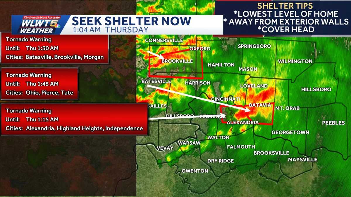
The tornado warnings issued across the Greater Cincinnati area on June 16, 2026, highlighted an escalating dependency on high-frequency digital communication to ensure regional public safety. As meteorological conditions deteriorated, automated alert systems emerged as the primary mechanism for disseminating life-critical information to a geographically dispersed population.
Broadcasters such as WLWT and FOX19 have shifted toward mobile-first, granular notification architectures. By utilizing app-based ecosystems, these organizations circumvent traditional broadcast latency, delivering localized data directly to high-risk zones, including Butler, Boone, and Dearborn counties, in near real-time.
Operational Dynamics of Atmospheric Risk Management
The evolution of the ‘Enhanced Risk’ (Level 3/5) designation underscores the volatility of atmospheric modeling and the corresponding requirement for rapid emergency response adjustments. When convective systems shift, local authorities face an increased operational burden to recalibrate public messaging, balancing the need for urgency with the risk of ‘alert fatigue.’
The nocturnal timing of the event—between midnight and 5 a.m.—exposed limitations in passive broadcast models. This period necessitated a transition toward active, push-based notification systems capable of bypassing human sleep cycles to alert residents of imminent threats, including 70 mph wind gusts and embedded tornadic rotation.
Institutional Coordination and Infrastructure Resilience
The synergy between the National Weather Service and regional media is a structural pillar of the Tri-State area’s disaster mitigation strategy. This relationship optimizes the speed of data transmission, which is directly linked to the mitigation of physical and economic exposure during extreme weather events.
Flash flood warnings affecting Ripley, Dearborn, and Ohio counties further emphasized the necessity of a multi-layered response. By synthesizing meteorological telemetry with local topographic vulnerabilities, institutions provided actionable intelligence rather than raw, non-contextual data.
Socioeconomic Impacts of Meteorological Volatility
The June 2026 event demonstrated that weather-driven disruption extends beyond immediate property damage, impacting regional logistics and labor stability. The reliance on digital platforms, however, exposes a ‘digital divide’ regarding public safety. Access to real-time information remains heavily contingent on technological literacy and device penetration. Closing this gap is essential to ensure that emergency communication reaches all demographic segments.
Adaptive Planning for Future Resilience
The June 2026 response serves as a critical case study for adaptive regional planning. Future preparedness strategies must prioritize the integration of AI-driven predictive modeling with automated, hyper-local alert dissemination. By reducing the reliance on human manual intervention, authorities can improve warning precision, minimize false alarms, and optimize resource allocation during peak convective threats.