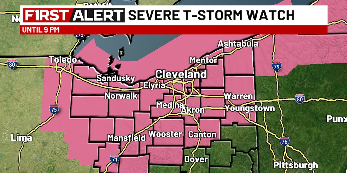
The convergence of a high-velocity cold front with localized atmospheric energy impulses has established a complex, multi-layered risk environment for Ohio’s regional emergency management and infrastructure oversight. Meteorological data indicates a bifurcated threat profile: Northeast Ohio is navigating immediate convective risks, while the Dayton corridor manages isolated, high-intensity energy surges. This atmospheric volatility requires a strategic realignment of public safety assets to mitigate the impact of straight-line winds and potential tornadic development.
Operational Dynamics and Wind Threshold Vulnerabilities
Tornado warnings for Cuyahoga, Geauga, and Lake counties underscore the immediate threat to high-density residential and industrial sectors. Strategic response efforts are currently prioritized for the primary storm cluster, which achieved peak intensity near 7:00 p.m. local time. The observation of ping-pong ball-sized hail and 70 mph wind gusts represents a critical mechanical failure point for legacy utility distribution lines and temporary structures, introducing substantial exposure for property insurers and grid operators.
Institutional stakeholders are monitoring the transition to a more organized secondary wave tracking ahead of the primary cold front. Projected to impact the lakeshore between 8:00 p.m. and 9:00 p.m., this phase shifts the risk profile toward southeastern counties by midnight. This progression creates a narrow logistical window for emergency services as the threat migrates from urban centers to distributed rural infrastructure, necessitating localized warning activation and rapid shelter protocol deployment.
Hydrological Saturation and Municipal Asset Load
Beyond convective threats, the transition into April 1st introduces sustained hydrological stress characterized by significant rainfall accumulation. Forecasts indicating pockets of precipitation exceeding 1.5 to 2 inches place direct load on municipal drainage systems and low-lying transit corridors. Given the current atmospheric instability, soil saturation levels are expected to reach capacity, increasing the probability of high-velocity surface runoff and flash flooding.
The strategic management of these water volumes requires precise coordination between public works and regional water authorities. Infrastructure near the Northeast Ohio lakeshore faces dual pressure from potential storm surges and inland precipitation. Decision-level significance is currently focused on pre-positioning water extraction equipment and identifying high-risk zones for road closures to prevent supply chain disruptions through the Ohio logistics corridor.
Regional Volatility and Strategic Cadence: Dayton Corridor
In Southwest Ohio, the focus remains on isolated energy impulses that present a distinct risk profile compared to the broader northern front. These impulses serve as catalysts for damaging straight-line winds, particularly north of Dayton’s city center. This localized volatility requires granular risk assessment, as individual storm cells can reach peak intensity rapidly, challenging standard alert timelines.
The operational cadence for the Dayton region will transition from acute Tuesday threats to a chronic pattern of intermittent precipitation through Wednesday. This shift impacts the scheduling of outdoor industrial activities and large-scale construction. Strategic decision-makers in transportation are adjusting operational windows to account for these fluctuating conditions, relying on real-time data platforms like Storm Center 7 to institutionalize rapid-response public safety measures.
Economic Outlook: Cold Front Progression and Holiday Logistics
The broader strategic outlook is defined by a primary cold front projected to cross the state between Saturday night and early Easter Sunday. This timing is critical for the retail and hospitality sectors, as it intersects with a high-volume holiday weekend. The shift to cooler, breezy conditions with temperatures in the 50s will likely alter consumer traffic patterns and influence outdoor event planning.
For agricultural and landscaping stakeholders, this transition marks a shift from active threat mitigation to recovery and damage assessment. While the air mass stabilizes post-front, utility providers must remain in a state of readiness; sustained post-frontal winds can further compromise infrastructure weakened during the initial storm cycle. The integration of digital alerting systems and multi-channel communication remains a benchmark for evaluating the efficacy of regional disaster mitigation and market stability.