Operational Mechanics of the Convective Front
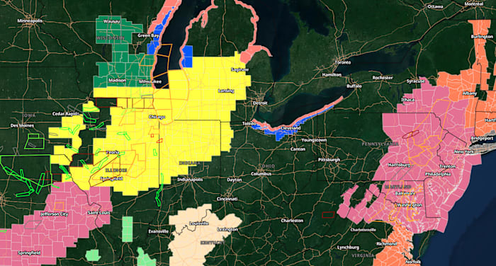
The National Weather Service (NWS) Detroit/Pontiac office has defined a critical meteorological window between 9 p.m. Thursday and 1 a.m. Friday for the passage of an organized, severe convective line. Nocturnal storm systems present elevated risk profiles; reduced visibility and delayed public response cycles complicate emergency management. Municipal authorities across the targeted impact zones must implement active overnight monitoring to minimize warning latency and coordinate rapid hazard response.
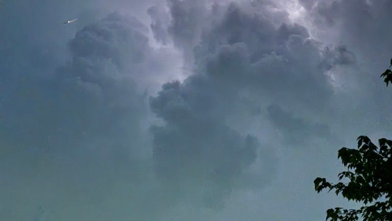
Driven by a dynamic cold front crossing Lower Michigan, this convective system introduces severe threats, including destructive straight-line winds exceeding 70 mph, large hail, and isolated tornadic spin-ups. Because the severity of these hazards depends on the physical integrity of the squall line as it moves eastward, real-time diagnostic scanning remains essential. Industrial facilities, logistics providers, and late-shift manufacturing plants must prepare for immediate operational contingencies during these high-risk hours.
The NWS tornado watch, active until 2 a.m. Friday, encompasses six Michigan counties: Bay, Genesee, Livingston, Midland, Saginaw, and Shiawassee. This primary risk corridor directly threatens key municipal and economic hubs, including Bay City, Brighton, Durand, Flint, Fowlerville, Howell, Midland, Owosso, and Saginaw. The concentration of atmospheric instability along this path leaves major southern metropolitan zones—such as Wayne, Oakland, Macomb, and Washtenaw counties—temporarily outside the primary alert envelope, allowing state-level emergency planners to optimize asset pre-positioning.
Compounding Infrastructure Vulnerabilities: Tuesday’s Tornadic Baselines
This incoming convective threat succeeds two documented tornado touchdowns on Tuesday afternoon, which established a physical baseline of structural degradation in central Michigan. The first tornado, touching down north of Freeland at approximately 1:14 p.m., compromised the building envelopes of 30 to 40 residential structures, causing localized envelope breaches, roofing failures, and siding loss. Additionally, the destabilization and overturning of recreational vehicles and campers in the area highlighted the extreme vulnerability of unanchored, non-permanent structures to lateral wind shear.
The second tornado occurred at 1:19 p.m., striking an agricultural zone near Montrose in Genesee County—approximately 42 miles from the Freeland event. Although its open-space trajectory minimized direct property damage, the rapid, near-simultaneous initiation of these distinct vortices underscores the high thermodynamic volatility of the broader atmospheric setup. This spatial distribution of damage demonstrates how quickly localized hazards can manifest across a wide regional footprint, leaving little lead time for structural securing.
Macroeconomic, Insurance, and Supply Chain Implications
Successive severe weather events within a compressed 48-hour window create compounding liabilities for the regional insurance, construction, and agricultural sectors. Property and casualty carriers must process an immediate influx of claims from the Tuesday events while simultaneously modeling exposure for the subsequent Thursday night system. This concurrent caseload stresses claims-adjusting capacity, potentially prolonging the transition from emergency mitigation to permanent structural reconstruction.
For residential property owners, the lack of recovery time between storms elevates the risk of secondary loss. Partially compromised structures, such as those with temporary roof coverings or damaged building envelopes, are highly susceptible to catastrophic water ingress during subsequent downpours. In the agricultural sector, particularly within Genesee and Saginaw counties, the dual threat of large hail and sustained high winds risks physical crop damage and accelerated soil erosion, highlighting the importance of robust risk-diversification and insurance hedging.
Furthermore, these impacted counties house vital manufacturing and logistics corridors. Wind gusts exceeding 70 mph threaten major freight transit paths, complicating just-in-time logistics. Industrial facilities operating continuous evening shifts must maintain strict weather-activation protocols; transition to warning status requires immediate cessation of outdoor handling operations and sheltering of personnel. Localized flash flooding from high-precipitation storm cores can also temporarily submerge low-lying highway infrastructure, disrupting both supply chains and emergency service routing.
Utility Grid Integrity and Long-Term Mitigation Frameworks
The electrical transmission and distribution grid faces significant physical stress from projected high-wind vectors. Sustained winds and convective gusts can snap utility poles, down overhead conductors, and cause widespread tree-canopy interference. For regional power providers, the late-night storm window limits safe aerial damage assessment, requiring pre-staged restoration crews to wait until daylight for comprehensive systemic repairs. The prospect of localized tornadic damage to sub-stations presents a catastrophic threat that would require complete infrastructure rebuilding rather than routine line re-fusing.
These recurring convective threats emphasize the necessity of updating municipal building codes and emergency response infrastructure. As seen in the residential envelope damage in Freeland, traditional light-frame construction remains vulnerable to tornadic wind pressures. Policymakers must evaluate structural resilience standards for new residential developments, particularly regarding roof-to-wall connections and impact-resistant materials. Long-term regional resilience depends on integrating advanced meteorological warning systems with hardened utility infrastructure and updated local zoning ordinances.