The mesoscale convective system that swept through Northern and Central Oklahoma from late Sunday, June 21, 2026, into the early hours of Monday, June 22, 2026, serves as a high-stress evaluation of regional emergency management and utility infrastructure. Characterized by severe straight-line winds, large hail, and localized tornadic threats, this rapid-onset weather event tested the real-time telemetry, hazard-deconfliction, and public warning pipelines of meteorological and municipal networks.
Kinematics and Meso-Beta Scale Propagation
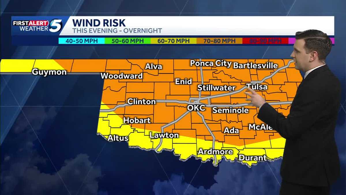
Exhibiting high translational velocity, the convective line propagated southeastward at 50 to 55 miles per hour. This rapid velocity compressed emergency decision-making windows, requiring dynamic updates to warning polygons. Initial diagnostic assessments by meteorologist Joseph Neubauer identified a hybrid hazard profile: a low-probability, high-impact tornadic threat coupled with a widespread, destructive straight-line wind field and significant hail core potential.
By 1:47 a.m. on Monday, rapid upscale growth of the storm system prompted the National Weather Service to issue a broad-corridor severe thunderstorm warning encompassing Washita, Comanche, Grady, Caddo, Stephens, Jackson, Kiowa, Tillman, and Canadian counties. The convective boundary was highly organized along a line extending southeast of Hobart, through Carnegie, to northeast of Gracemont. As the system advanced toward the Oklahoma City metropolitan area, its internal dynamics maintained destructive potential, leading to refined warning corridors by 1:52 a.m. stretching from Meridian to Minco, directly intercepting suburban and municipal infrastructure zones.
Structural Asset Vulnerabilities and Empirical Verification
At approximately 1:45 a.m., concurrent power flashes documented in El Reno and Oklahoma City provided immediate empirical evidence of grid-level mechanical failures. Observed and recorded by KOCO 5 First Alert Storm Chaser Shane Helton, these transient electrical arcs indicate physical contact between conductors or structural failures of distribution poles under wind loads estimated to exceed 80 miles per hour.
Winds of this magnitude expose systemic vulnerabilities in overhead distribution networks, particularly where vegetation encroachment or material fatigue exist. Rather than isolated incidents, the synchronized failure of these assets across El Reno and Oklahoma City points to a broad, high-velocity wind front. Integrating mobile storm chasers like Helton into the broader observation network provides essential ground-truth verification. This real-time feedback loop allows meteorologists to calibrate radar velocity signatures with observed surface damage, validating warning urgency and reducing false-alarm latency.
Multi-Channel Telemetry and Latency Reduction
Managing this nocturnal convective event demonstrated the necessity of decoupled, multi-channel communication strategies. Broadcast networks, including KOCO 5, deployed a diversified delivery model across linear television, push-notification applications, targeted digital newsletters, and low-latency streaming platforms like YouTube. This redundant dissemination model bypassed the limitations of traditional broadcasting during late-night hours when standard viewership is minimal, ensuring direct-to-device alerts reached populations in the storm’s path.
Inter-Agency Warning Protocols and Hazard Deconfliction
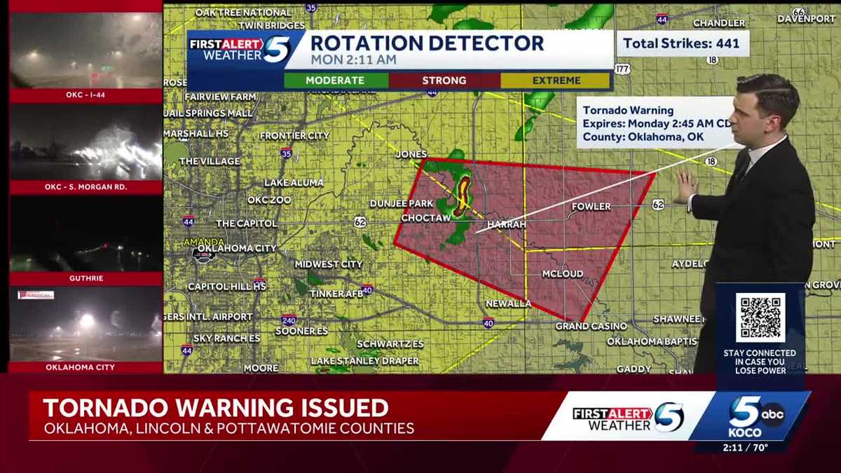
The simultaneous management of overlapping tornado and severe thunderstorm warnings during the early hours of June 22 highlighted the operational complexity of inter-agency warning protocols. The National Weather Service and broadcast teams evaluated radar telemetry to balance public clarity with meteorological accuracy. This was demonstrated as a localized tornado warning remained active until 1:45 a.m. for a discrete convective cell, while broader high-wind warnings were issued for adjacent counties. This dual-track approach managed distinct, co-occurring threats—mesocyclonic rotation and straight-line winds—allowing county-level emergency management agencies to deploy resources tailored to localized hazards.
Systemic Infrastructure Hardening Paradigms
The grid disruptions in El Reno and Oklahoma City underscore the ongoing financial and operational challenges of maintaining overhead electrical infrastructure. The high-velocity winds of June 21–22 emphasize the need for systemic grid hardening. Post-event diagnostic data is vital for utility providers planning targeted capital expenditures, such as selective line undergrounding and upgrading structural supports. Ultimately, this event highlights the continuous need for technological integration, inter-agency coordination, and physical asset reinforcement to mitigate the impacts of severe convective systems.