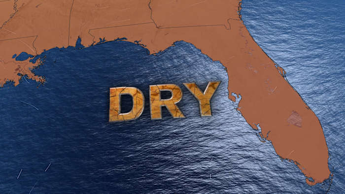
Central Florida is experiencing a notable departure from typical summer convective patterns, primarily driven by a persistent upper-level high-pressure system. This atmospheric anomaly is actively suppressing daily storm cycles, leading to uncharacteristically low rainfall probabilities across the interior.
The high-pressure dome acts as a thermal lid, inhibiting the vertical development of clouds crucial for precipitation. This meteorological condition directly impacts stakeholders in agriculture and water management, necessitating a shift from reliance on natural rainfall to more intensive irrigation and strategic resource allocation.
Ambient temperatures are forecast to peak in the mid-to-upper 90s Fahrenheit, with heat indices projected to reach between 100°F and 105°F. This elevated heat index represents a critical threshold for operational safety, particularly concerning outdoor labor productivity and the strain on the electrical grid’s peak demand management capacity.
Institutional responses to these extreme conditions are formalized through frameworks such as ‘Impact Weather’ and ‘Severe Weather Warning Days.’ ‘Impact Weather’ designations flag conditions disruptive to daily activities and transportation, prompting operational adjustments in logistics and transit.
‘Severe Weather Warning Days’ indicate a higher tier of risk, posing direct threats to life or property. The recent expiration of severe thunderstorm warnings in Osceola and Brevard counties, despite the overall rain suppression, highlights the localized volatility within the larger atmospheric pattern.
The anticipated breakdown of the current high-pressure system by week’s end is expected to allow for a marginal increase in precipitation, offering a brief window for hydrological replenishment. However, a new high-pressure system is forecast to build over the weekend, reinforcing the cycle of heat and dry conditions.
Southwest Florida’s meteorological setup mirrors this trend, with temperatures reaching the lower-to-mid 90s Fahrenheit. Observed rainfall patterns, concentrated along and west of the I-75 corridor, demonstrate the geographic specificity of moisture distribution, favoring inland areas over coastal zones.
A projected shift in wind patterns by the weekend is anticipated to redistribute rain chances toward the coast. This transition is crucial for coastal municipalities that have experienced prolonged dry spells, potentially mitigating cumulative thermal stress on urban infrastructure.
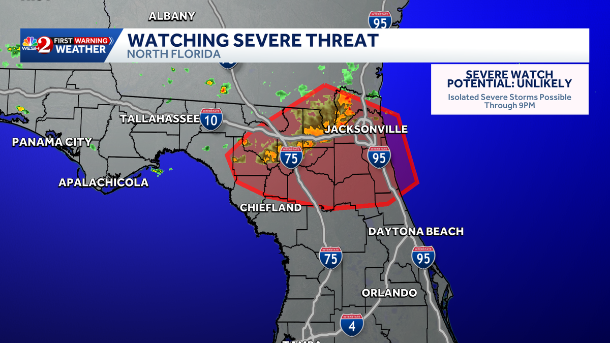
The role of meteorological authorities, including WESH 2 and WINK News, remains vital for regional risk mitigation. Their tracking of storm cells moving southeast across North Florida, with potential impacts on Flagler County, underscores the necessity of continuous monitoring of localized weather phenomena within the broader high-pressure regime.
Strategic Implications of Atmospheric Stagnation
The persistence of high-pressure systems over Florida creates a feedback loop of atmospheric stagnation and rising surface temperatures. This stagnation prevents the natural cooling effect of afternoon thunderstorms, typically acting as a thermal regulator for the region.
For energy providers, the absence of these convective cooling events during peak heating hours leads to sustained high demand for air conditioning, challenging the resilience of the electrical distribution network. The financial implications of this demand surge are significant, impacting both residential and commercial sectors through elevated utility costs.
The agricultural sector faces a parallel challenge. The reduced probability of rainfall compels increased reliance on groundwater extraction, raising production costs and exerting additional stress on the Floridan Aquifer, especially during extended dry periods.
The cyclical nature of high-pressure system transitions, beginning anew over the weekend, suggests a structural pattern rather than a transient event. This predictable sequence of building and breaking pressure systems indicates a period of atmospheric volatility that complicates long-term planning for construction and outdoor events.
Operational Risk and Public Safety Frameworks
The distinction between nuisance disruptions and direct threats to life is formalized in meteorological reporting via ‘Impact Weather’ versus ‘Severe Weather Warning Days.’ This classification system enables institutional leaders to implement data-driven decisions regarding public safety and resource deployment.
The recent expiration of severe thunderstorm warnings in Osceola and Brevard counties exemplifies the rapid lifecycle of storms that manage to penetrate the high-pressure cap. These localized, transient events can still cause significant property damage, necessitating prompt response from emergency services.
Meteorologists, such as Tony Mainolfi and the First Warning Weather team, emphasize the critical importance of real-time tracking via radar and mobile alerts. This technological integration is essential for maintaining situational awareness in an environment where weather patterns can shift rapidly from suppressed rain to severe storms.
In Southwest Florida, the I-75 corridor’s role as a primary zone for storm development offers a geographic baseline for logistical planning. Businesses operating in these inland areas must factor in the potential for 40% rainfall coverage when managing supply chains and field operations.
The anticipated wind shift toward the weekend signifies a tactical change in the regional environment. By repositioning rain chances closer to the coast, this shift could provide relief to high-density urban areas experiencing the most intense heat accumulation.
Economic and Institutional Consequences
The economic impact of a sustained heat index between 100°F and 105°F extends beyond utility costs to encompass potential losses in labor productivity. Industries including construction, tourism, and agriculture must implement stringent heat mitigation protocols to protect their workforce, which can lead to project delays and increased overhead.
Tourism, a cornerstone of Florida’s economy, is highly sensitive to ‘Impact Weather’ designations. Disruptions to travel and outdoor recreational activities at theme parks and coastal resorts can result in immediate revenue fluctuations and potential long-term shifts in visitor behavior.
Institutional resilience is tested by the need to effectively communicate complex weather patterns to a diverse public. The strategic use of specific terminology, such as ‘heat index’ and ‘pressure system breakdown,’ aims to provide a more nuanced understanding of risks beyond simple temperature readings.
The recurring nature of these high-pressure cycles suggests the urgent need for structural adjustments in urban planning. Enhancing the thermal resilience of infrastructure and expanding green spaces to mitigate urban heat island effects are critical long-term strategies amplified during these prolonged heat events.
As a new high-pressure system builds for the weekend, the cycle of heat intensification and rain suppression is likely to recommence. This predictability allows for a degree of forward planning, yet the inherent volatility of the atmosphere remains a constant factor in regional risk management.
Continuous monitoring by entities like the WINK News Weather Authority and WESH 2 provides essential data for these strategic adjustments. Their focus on the interplay between humidity, temperature, and pressure systems offers a comprehensive view of the challenges facing the Florida peninsula in the immediate future.