The Operational Impact of Tropical Storm Arthur
Tropical Storm Arthur, the inaugural system of the 2026 Atlantic hurricane season, highlights the systemic dangers posed by low-intensity, high-precipitation tropical systems. Despite lacking hurricane-force winds, the storm’s slow movement over the Gulf Coast—specifically Louisiana and Mississippi—triggered a hydrological crisis that bypassed conventional wind-damage risk models.
Data from the National Hurricane Center and NASA’s Terra satellite confirm a critical shift from structural wind vulnerability to prolonged, severe inundation. This transition underscores a persistent blind spot in regional risk modeling, where the meteorological focus often underestimates the saturation capacity of low-lying terrain.
Hydrological Extremes and Infrastructure Stress
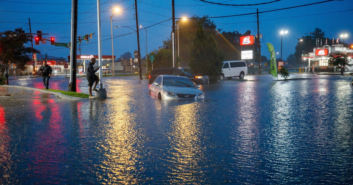
Rainfall totals exceeding 22 inches in Plaucheville, LA, served as a stress test for existing civil engineering, revealing the inadequacy of current drainage infrastructure. The subsequent flooding of at least 200 homes in Avoyelles Parish demonstrates that regional water management systems are frequently overwhelmed by localized, high-intensity precipitation events.
Emergency operations, such as the rescues in Perkinston, MS, indicate that when infrastructure design capacity is breached, the logistical burden on municipal response teams increases exponentially, often requiring improvised interventions that deviate from standard operating procedures.
Economic and Institutional Consequences
The economic footprint of the storm encompasses immediate property loss, increased insurance risk-loading, and the fiscal strain of emergency response on municipal budgets. For local governments, the sudden pivot to life-safety operations during post-storm cleanup periods creates a critical funding gap in local disaster management.
Institutional stakeholders are currently tasked with navigating the conflict between immediate disaster recovery and the high capital requirements for structural resilience upgrades. Furthermore, the secondary hazards identified during post-storm cleanup suggest that current emergency frameworks remain insufficiently prepared for the longitudinal risks that follow a primary meteorological event.
Strategic Implications for Regional Planning
Arthur emphasizes the urgent need for hyper-local predictive modeling. While infrared brightness temperature analysis provides essential data on rainfall potential, current administrative barriers impede the rapid translation of this data into actionable evacuation or mobilization orders.
The real estate and insurance sectors face significant hurdles due to the failure of traditional flood maps to account for hyper-local hydrological intensity. This discrepancy creates systemic misalignments in risk-based pricing, leaving municipalities and homeowners vulnerable to insurance coverage gaps during extreme, localized inundation.
Systemic Vulnerabilities in the Gulf Coast
The Gulf Coast’s combination of flat topography and saturated soil creates a unique risk profile, particularly for high-density, low-income residential areas and aging infrastructure. The reliance on mobile home clusters in these flood-prone zones remains a primary driver of displacement and property loss.
The necessity for unconventional rescue tactics underscores the equipment-gap facing first responders. Modernizing emergency fleets to include specialized craft capable of navigating shallow, debris-laden urban floodwaters is a critical requirement for future-proofing local agencies against high-precipitation events.
Policy Considerations for Future Resilience
The lessons from Arthur necessitate a policy pivot toward integrating satellite-derived meteorological data directly into municipal land-use and drainage-maintenance frameworks. Enhancing the interoperability of federal meteorological intelligence and local emergency management workflows is essential to reducing the current administrative latency in disaster response and ensuring robust long-term urban resilience.