Meteorological Diagnostics and Cyclogenesis Trajectory
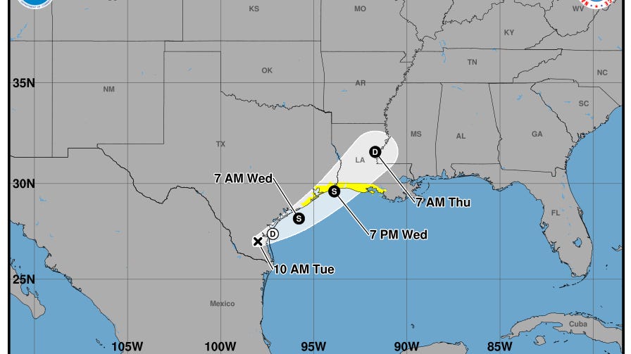
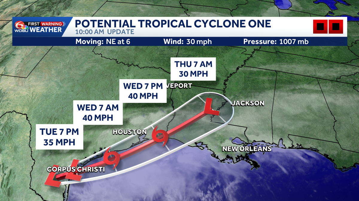
The designation of Invest 90-L over southern Texas and northern Mexico highlights an active zone of potential tropical cyclogenesis. Classified as a potential tropical cyclone by the National Hurricane Center, the system carries a 60% probability of transitioning into Tropical Storm Arthur as it migrates over the warm waters of the Gulf of America. This developmental window is highly constrained, concentrating primarily between Tuesday, June 16, and Wednesday, June 17, prior to its projected land interaction. Thermodynamically, transition relies on the system establishing an organized, warm-core atmospheric structure with sustained winds reaching the 39 mph storm threshold.
For emergency managers and regional planners, this rapid evolution compresses critical preparation timelines. Even if vertical wind shear or land proximity prevents the system from meeting formal tropical storm classification criteria, the moisture reservoir associated with the disturbance remains immense. Consequently, risk mitigation protocols must prioritize the system’s hydrological payload over wind-velocity thresholds, as the primary threat vector is sustained, multi-day precipitation.
Hydrological Risk Vectors and Civil Infrastructure Limits
Quantitative precipitation forecasting indicates widespread accumulations of 3 to 6 inches over a five-day period, which remains within the operational tolerances of regional drainage infrastructure. However, meteorological modeling warns of high-density convective clustering capable of producing localized rainfall totals exceeding 12 inches. Such extreme volumes present an acute threat of flash flooding, particularly within low-lying coastal basins, urban corridors characterized by high soil-imperviousness, and areas exhibiting elevated antecedent soil moisture.
Reflecting this systemic vulnerability, a Flood Watch has been declared through Friday morning for Louisiana’s Northshore, the River Parishes, portions of the Bayou Parishes, and the New Orleans metropolitan area. When precipitation intensity outpaces both the infiltration capacity of regional soils and the mechanical capacity of municipal pumping networks, rapid surface ponding occurs. Furthermore, because regional watersheds are highly interconnected, runoff from inland parishes directly compounds downstream flooding in adjacent coastal jurisdictions, requiring coordinated basin-wide water management strategies.
Supply Chain Volatility and Macroeconomic Exposures
The geographic corridor threatened by Invest 90-L represents a vital hub for national logistics, petrochemical refining, and maritime trade. Localized infrastructure failures can cause cascading supply chain disruptions. Inundation of key arterial highways and rail corridors delays the transport of raw materials, while high-water conditions in maritime shipping lanes can restrict vessel traffic through major ports in the Gulf of America.
These disruptions also carry significant regulatory and financial implications. For offshore energy operators and maritime logistics firms, the operational transition from an unnamed invest to a named tropical storm serves as a contractual and insurance trigger. Standard safety protocols mandate specific asset-securing and personnel-evacuation procedures based on these formal classifications. Additionally, because commercial flood damage falls under distinct underwriting structures compared to wind-driven hazards, localized flooding along this industrial corridor represents a complex risk-management challenge for underwriters and corporate risk officers alike.
Bilateral Coordination and Long-Term Structural Resilience
The transboundary origin of Invest 90-L over northern Mexico and southern Texas underscores the necessity of continuous, bilateral scientific cooperation. Managing shared watersheds, such as the Rio Grande Valley, during extreme meteorological events requires real-time data sharing regarding reservoir capacity and coordinated water releases to mitigate downstream flooding. Administratively, the federal designation of the Gulf of America emphasizes the strategic integration of this maritime zone within national resource-management and safety frameworks, demanding close coordination between the U.S. Coast Guard, industrial operators, and municipal emergency services.
Over the long term, the recurring threat of high-volume tropical disturbances underscores the limits of legacy drainage systems. To preserve design safety standards, municipal planners must incorporate adaptive infrastructure strategies. Integrating green infrastructure—such as urban retention basins and bioswales—alongside mechanical pumping upgrades and elevated electrical controls is essential to buffer peak runoff and ensure operational continuity during extreme precipitation events.