Atmospheric Dynamics Across Northeast Ohio
A sequence of weak atmospheric disturbances is crossing Northeast Ohio, sustaining elevated boundary-layer humidity and intermittent convective precipitation through the weekend. Regional forecast models indicate discrete, localized convective impulses rather than a broad, uniform synoptic system. This spatial distribution presents distinct operational challenges for municipal drainage networks and regional transit corridors.
The initial pulse initiates post-midnight, concentrating higher precipitation rates along and south of the US-30 corridor. While forecasters do not anticipate regional riverine flooding, isolated spot-specific ponding and culvert capacity overruns remain primary operational hazards. Northward toward the Lake Erie shoreline, activity remains characterized by scattered showers and isolated thunder, with cloud cover anchoring early temperatures in the upper 60s to lower 70s.
Hydrological Vulnerabilities Along the US-30 Corridor
The positioning of the quasi-stationary boundary focuses initial hydrological loading on southern counties, including Holmes and Tuscarawas. In these sectors, short-duration downpours can rapidly saturate topsoil and exceed local drainage limits. Commercial freight and logistics operators along US-30 face acute hazards from sudden visibility drops and hydroplaning.
A diurnal lull following the overnight system creates a temporary Friday drying window, though boundary-layer moisture persists. Insolation through partial cloud breaks is projected to lift afternoon temperatures into the 80s, generating thermodynamic instability that primes the environment for secondary convective initiation along the stalled boundary.
Weekend Convective Trajectory and Cumulative Runoff
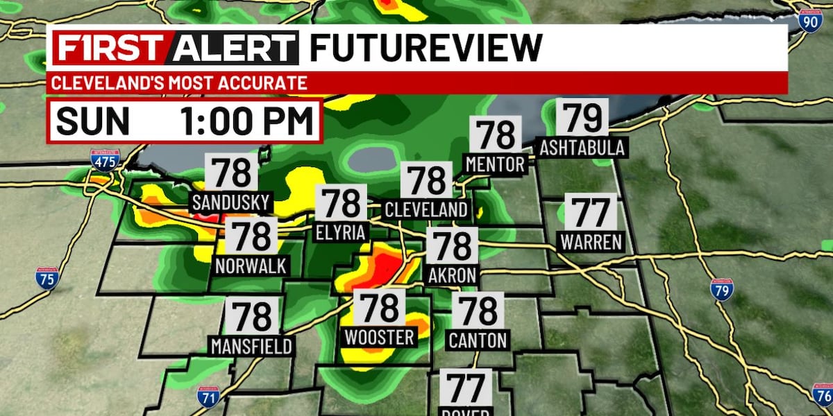
Saturday features intermittent morning activity followed by a stronger atmospheric impulse converging during the evening hours. This back-loaded diurnal profile elevates the probability of organized thunderstorm clusters and localized downpours over already-dampened basins.
By Sunday, cumulative precipitation reaches its peak operational significance. Saturated soils will exhibit reduced infiltration capacities, shifting flood vulnerability from isolated drainage ponding to systemic surface water runoff. Municipal public works departments and transit authorities must align surveillance and deployment schedules with these progressively compounding hydrological impacts.
Infrastructure Resilience and Civil Mitigation Priorities
In the Cleveland metropolitan core, aging stormwater infrastructure faces localized ponding risks during short-duration, high-rate downpours. Proactive catch-basin clearing and rapid-response road closures along depressed arterials represent key mitigation measures.
Conversely, rural and agricultural southern districts face silt accumulation and road-shoulder erosion along secondary routes. Given the microclimatic divergence between Lake Erie coastal zones and the southern interior, emergency management frameworks must deploy targeted, real-time radar monitoring to manage these non-severe yet cumulative hydrological risks.