
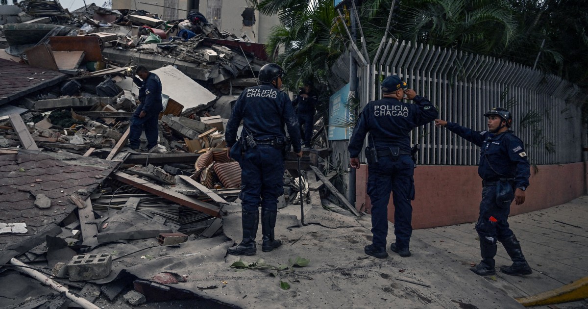
A significant 7.1-magnitude earthquake struck the northern coast of Venezuela on Wednesday, originating near the industrial hub of Morón. Data from the United States Geological Survey (USGS) identifies the event as a shallow crustal rupture, occurring at a depth of 13 kilometers. This proximity to the surface amplified energy propagation across the northern administrative corridor, notably impacting the capital, Caracas, situated 168 kilometers from the epicenter.
Tectonic Parameters and Energy Propagation
The earthquake’s 13-kilometer focal depth classifies it as a high-intensity surface event. In seismological terms, shallow quakes offer less distance for energy attenuation, resulting in more violent ground motion compared to deeper subduction events. The energy release interacted with the sedimentary basin of Caracas, causing high-rise structures to experience significant resonance and visible swaying. This phenomenon, while alarming, is often a calculated function of modern seismic engineering designed to dissipate kinetic energy through controlled flexibility.
Urban Resilience and Evacuation Protocols
The immediate aftermath saw a rapid, organized evacuation of high-density residential and commercial districts in Caracas. This proactive response highlights a high level of civic readiness, though it also underscores the psychological impact of major seismic events in a region defined by the Caribbean-South American plate boundary. Preliminary assessments suggest that the lack of immediate structural collapse indicates that current built environments reached, but did not exceed, their critical failure thresholds.
Infrastructure and Industrial Implications
The epicenter’s location—17 miles west of Morón—is strategically sensitive. This coastal zone serves as a vital nexus for maritime logistics and petrochemical infrastructure. While national authorities have not reported catastrophic damage to primary lifelines such as power grids or water systems, the event necessitates rigorous post-seismic inspections. Engineers focus on identifying latent structural fatigue, particularly in older masonry buildings and industrial facilities along the coast that may have suffered micro-fracturing.
Geopolitical and Risk Assessment Context
The 7.1-magnitude event serves as a stark indicator of the ongoing tectonic stress accumulation along Venezuela’s northern coast. The lag in comprehensive damage reporting from remote coastal areas remains a challenge for disaster management agencies. Moving forward, the focus shifts to monitoring aftershocks, which are common following shallow ruptures of this magnitude. This seismic event provides a critical dataset for refining regional building codes and improving the real-time responsiveness of Venezuela’s National Center for Seismology.

Photo by Makalu on Pixabay.