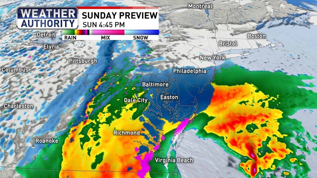
The National Weather Service’s issuance of a Winter Storm Watch across critical counties in Maryland and Virginia formally elevates risk assessment, mandating infrastructure and public safety sectors transition to heightened preparedness protocols.
The analytical core of this forecast lies in the stark divergence between primary models: the Global Forecast System (GFS) projects a high-impact, potentially 24-inch accumulation, directly contrasting with the European Centre for Medium-Range Weather Forecasts (EURO) model, which forecasts a conservative 6-inch outcome. This variance creates significant systemic risk and forces emergency management agencies to budget resources based on the upper-end threat profile.
Forecasting Disparity: Operationalizing Uncertainty
This model conflict forces governmental and essential service providers into a costly hedging strategy: mobilizing against the GFS worst-case scenario despite the EURO suggesting a moderate event. This dynamic directly impacts resource allocation efficiency.
The National Blend of Models (NBM) currently synthesizes inputs toward a statistically probable median of approximately five inches. However, this central tendency does not negate the systemic risk posed by high-variance outliers like the GFS projection, which dictate liability thresholds.
Logistical chains face immediate strain. Transportation authorities must pre-position plowing assets based on the highest credible threat, tying up capital and labor resources preemptively. Furthermore, the shift from cold rain to accumulating snow is anticipated after sunset, establishing a critical operational window for pre-event de-icing treatment during the warmer Saturday period.
Stakeholder Exposure and Snow Ratio Dynamics
Commercial entities must navigate ambiguity regarding inventory stabilization and Sunday staffing, weighing potential losses against overtime expenditures based on speculative snow totals. The Watch designation, rather than a Warning, confirms this model conflict, triggering readiness checks without mandating immediate, full-scale activation.
Geographic sensitivity analysis indicates higher accumulation potential (up to 6 inches) in zones north and west of the D.C. metro (e.g., Frederick, Carroll, Montgomery counties). These higher-elevation, colder zones favor higher snow-to-liquid ratios, dictating targeted initial resource deployment.
Coastal Storm Mechanics and Timing Sensitivity
The uncertainty is intrinsically linked to the track and intensity evolution of a developing coastal low-pressure system off the Carolinas. The storm’s final path depends on the precise interaction between mid-level steering currents and latent energy release.
The anticipated transition timeline—chilly rain mix early Sunday, evolving to wet snow by evening—demands staggered response. Wet snow poses a greater mechanical load on infrastructure and adheres more readily to surfaces and power lines, elevating the risk of limb failure compared to drier snow events. Initial surface temperatures near freezing in the D.C. core will generate icing hazards before heavier, colder precipitation arrives.
Strategic Communication and Economic Trade-offs
Meteorological outlets face pressure to contextualize both the high-impact potential (GFS) and the statistical median (NBM). The key communication imperative focuses on the post-sunset accumulation phase, signaling that the most hazardous travel window coincides with the end of typical weekday activity.
The mild Saturday presents a high-value window for utility pre-staging, allowing proactive line inspections before Sunday’s operational constraints. The economic calculus hinges on risk management: over-preparing for the GFS scenario incurs wasted expenditure, while under-preparing risks severe public safety disruption. The NWS extension through Monday afternoon signals expected residual impacts (clearing, refreezing).
Institutional Readiness and Model Calibration
The Watch triggers immediate authorization of emergency expenditures (overtime, materials), scaled according to the aggressive model outputs. The event serves as a real-time stress test for cross-jurisdictional coordination between counties like Frederick, Carroll, and Loudoun.
Long-term strategy refinement necessitates investment in proprietary ensemble modeling capabilities to better calibrate global model biases against local terrain dynamics. Preparedness must utilize a tiered system: baseline readiness for the NBM median, and surge capacity reserved strictly for the low-probability, high-consequence GFS outlier scenario. This event directly tests the agility of governance in scaling response efforts based on high-frequency NBM updates resolving the GFS/EURO conflict.