Synoptic Dynamics and Historic Convective Anomalies
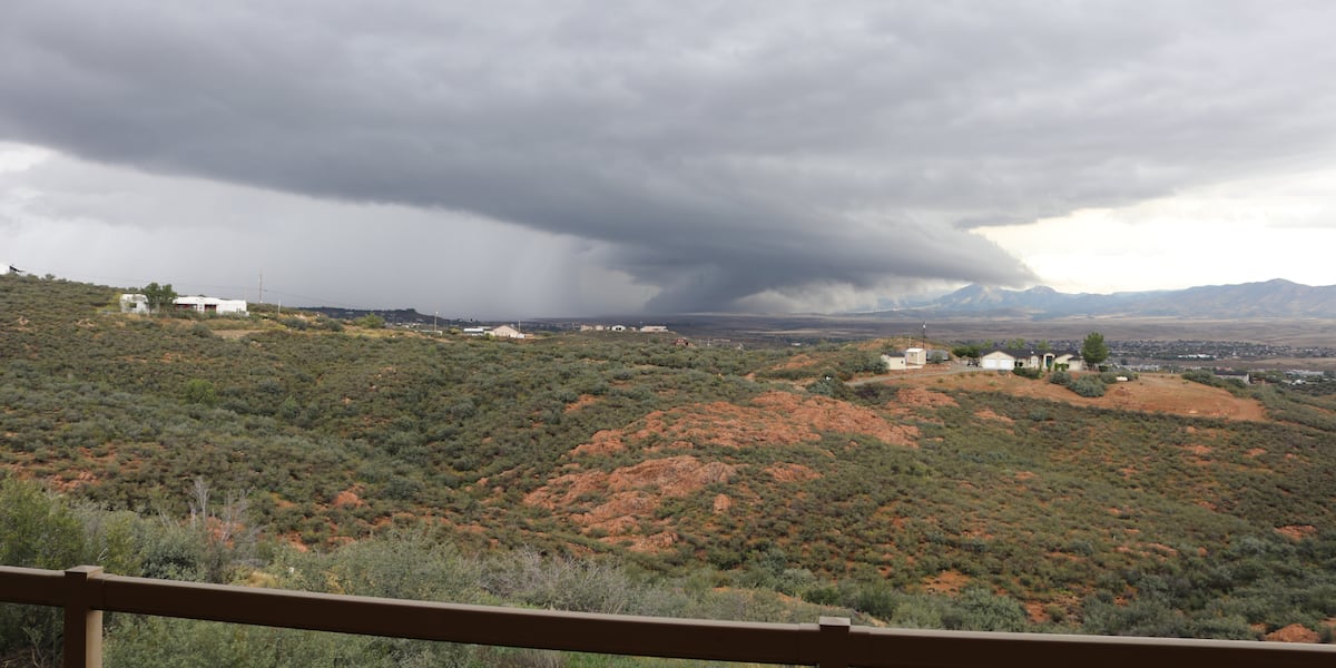
An exceptionally rare severe convective sequence destabilized northern Arizona on Wednesday, producing at least ten tornado warnings across high-elevation terrain. In response to rapid storm intensification, the National Weather Service issued an overarching Tornado Watch spanning northeastern, northern, and northwestern Arizona through early evening—the state’s first designated Tornado Watch in more than 15 years.
Atmospheric profiles across Coconino and Yavapai counties reached an enhanced Level 3 out of 5 severe convective risk threshold. Strong vertical shear and steep mid-level lapse rates sustained rotating updrafts capable of producing damaging, egg-sized hail alongside tornadic signatures unusual for high-desert plateaus.
Chronological Polygon Trajectory Across Yavapai and Coconino Counties
The National Weather Service Flagstaff forecast office initiated warning polygons early Wednesday morning as discrete storm cells matured:
- 06:15 MST Expiration: Initial warnings impacted high-altitude corridors and key recreational nodes in Coconino County, including Bellemont, Humphreys Peak, Lava River Cave, Abineau Canyon Trailhead, Wing Mountain, and the Inner Basin Pumphouse.
- 08:15 MST Expiration: The primary convective core shifted south into Yavapai County, prompting a radar-indicated polygon covering major municipal and aviation infrastructure across Prescott, Prescott Valley, Prescott Regional Airport, Mingus Mountain, Lynx Lake, and Willow Creek Reservoir.
- 08:45 MST Expiration: Persistent mesocyclone activity triggered a secondary Yavapai polygon encompassing Jerome, Woodchute Mountain, Parsons Spring, Jerome State Historic Park, Parsons Trailhead, and Tapco Verde River Access.
- 09:45 MST Expiration: Storm tracks shifted back over central Coconino County, blanketing metropolitan Flagstaff, Fort Valley, Mount Elden, University Heights, Rogers Lake, and A1 Mountain.
Ground Damage Verification Protocols and Infrastructure Exposure
Eyewitness reports and video evidence recorded a descending funnel cloud proximate to Dewey-Humboldt in Yavapai County, raising immediate safety concerns for high-risk housing and recreational vehicle parks lacking reinforced subterranean shelter. Arizona’s Family Chief Meteorologist Royal Norman noted visual confirmations of low-level rotation consistent with a potential tornado touching down near terrain level.
The National Weather Service withheld official EF-scale confirmation pending structured post-storm survey sweeps. Verifying physical touchdowns across topographically complex, sparsely populated regions requires detailed field analysis to differentiate tornadic shear tracks from downburst damage.
Compounding operational liabilities, all seven Hopi tribally controlled schools implemented proactive district-wide closures for Thursday, neutralizing transportation risks across saturated desert transit corridors.
Four Corners Hydrology and Multi-State Cascading Hazards
Regional instability expanded well beyond municipal boundaries, maintaining a severe thunderstorm watch across sectors of northern Arizona through 02:00 MST Thursday. Comprehensive statewide Flood Watches accompanied the convective activity as precipitable water anomalies accelerated runoff potential over compacted desert soils.
Downstream hydrologic threats converged on southwestern Colorado. The FOX Forecast Center identified a Level 3 out of 4 flash flood risk surrounding the Ferris Fire burn scar, where projected rainfall totals between 3 and 5 inches threatened sudden debris flows and structural soil failure across damaged watersheds.
The parent synoptic disturbance demonstrated remarkable spatial breadth, simultaneously channeling moisture plumes into coastal Southern California and generating a marginal tornadic environment along the Pacific coastline from Carmel south through the Los Angeles basin.