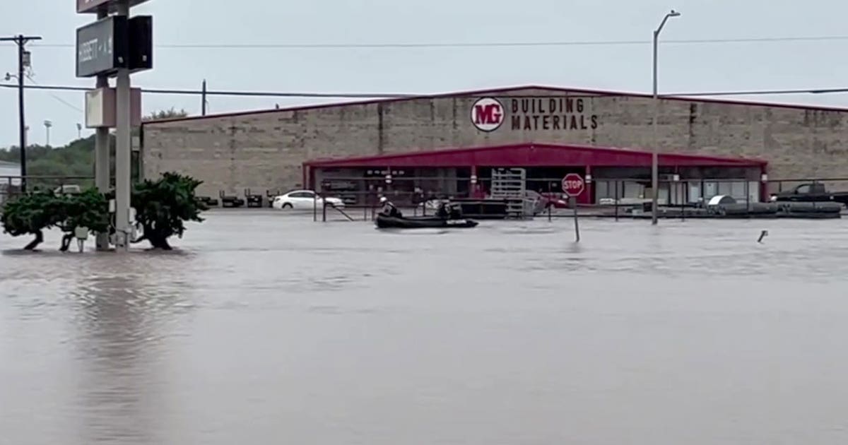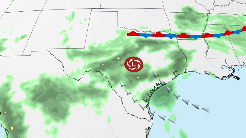
The gubernatorial declaration of a state of disaster across fifty-nine Texas counties underscores the acute systemic challenges facing the state’s emergency management infrastructure. Activating statutory mechanisms under Texas Government Code Chapter 418, Governor Greg Abbott’s executive order transitions the state’s tactical posture from localized mitigation to centralized, rapid asset reallocation. This administrative directive suspends specific regulatory barriers, enabling the Texas Division of Emergency Management (TDEM) to bypass standard procurement protocols and dynamically position resources. Encompassing major metropolitan hubs such as Harris, Bexar, and Travis counties alongside vulnerable rural sectors, the declared emergency highlights a wide-ranging threat to public safety, utility networks, and regional commerce.
Statutory Activation and Resource Staging Mechanics
By formalizing a state of disaster, the executive branch shifts the primary burden of operational coordination from localized municipal jurisdictions to a centralized state framework. This legal catalyst authorizes the state to deploy high-water rescue vehicles, tactical personnel, and aviation assets to high-risk zones ahead of peak hydrological activity. Proactive positioning is vital for reducing response times during flash flood events, as seen in Uvalde County where rapid-onset inundation has already necessitated emergency rescues. Additionally, this state-level declaration establishes the essential administrative and fiscal record required to request federal aid from the Federal Emergency Management Agency (FEMA) should local damage thresholds exceed state capacities.
Synoptic Meteorology and the Back-to-Back Level 4 Threat
The Weather Prediction Center (WPC) decision to issue consecutive Level Four of Four high-risk flood designations for south-central Texas represents an extraordinary meteorological event, marking the first such sequence since April 2025. This maximum tier of meteorological warning indicates a high probability of catastrophic, widespread flash flooding. Driven by a stagnant, moisture-rich atmospheric block, the storm system delivers rainfall rates of two to four inches per hour, with cumulative localized totals projected to exceed ten inches. For emergency planners, this back-to-back configuration is highly dangerous; antecedent rainfall from the first wave completely saturates regional soils, reducing infiltration capacity to zero and converting all subsequent precipitation directly into destructive runoff.
Karst Geomorphology and Hill Country Hydrology
The Edwards Plateau and western Hill Country possess unique geological vulnerabilities that amplify the speed and severity of flash flood events. Characterized by thin soils overlying dense karst limestone, these regions have almost no natural capacity to absorb sudden, high-intensity precipitation. Runoff rapidly accelerates down steep, rugged slopes, channeling massive volumes of water into dry creek beds and low-water crossings (LWCs). Because regional secondary roads rely heavily on these LWCs rather than elevated spans, even brief torrential downpours can sever critical transit corridors, isolate rural communities, and complicate rescue efforts by trapping emergency responders on opposing sides of fast-flowing water hazards.
Metropolitan Impervious Cover and Civil Engineering Limitations
The inclusion of Harris, Bexar, and Travis counties—encompassing Houston, San Antonio, and Austin—highlights the susceptibility of dense urban corridors to severe storm events. In these metropolitan centers, vast expanses of impervious concrete prevent natural infiltration, forcing runoff into engineered drainage networks. When rainfall intensity reaches two to four inches per hour, these storm sewers, concrete channels, and detention basins quickly exceed their design capacities. The resulting urban ponding paralyses transportation, floods subterranean infrastructure, and threatens electrical substations and water treatment plants, demonstrating the widening gap between historical engineering design standards and modern convective weather extremes.
Socioeconomic Impacts and Cross-Border Supply Chain Friction
Beyond immediate structural damage, the flood crisis introduces significant logistical friction into domestic and international supply chains. The affected region contains key transit corridors, including Interstate 35 and routes traversing the Rio Grande Valley, which facilitate major trade between the United States and Mexico. Flooded freight routes and border-crossing bottlenecks delay just-in-time logistics, impacting manufacturing and agricultural distribution networks nationwide. Saturated fields and flooded pastures also threaten regional agricultural yields, while compromised access roads disrupt service operations within the state’s energy corridors, illustrating how localized environmental shocks can cascade into broader economic disruptions.