Atmospheric Dynamics in the Atlantic and Gulf Basins
The National Hurricane Center (NHC) is actively evaluating two separate tropical disturbances during the climatological peak of the 2026 Atlantic hurricane season. Forecasters are tracking Invest 97-L in the northern Gulf of Mexico alongside the disorganized moisture envelope of the remnants of Tropical Storm Dolly traversing the northeastern Caribbean. Both systems present distinct operational risks to municipal drainage networks, offshore energy infrastructure, and regional water management systems.
Invest 97-L: Cyclogenesis Threat to the Northern Gulf Coast
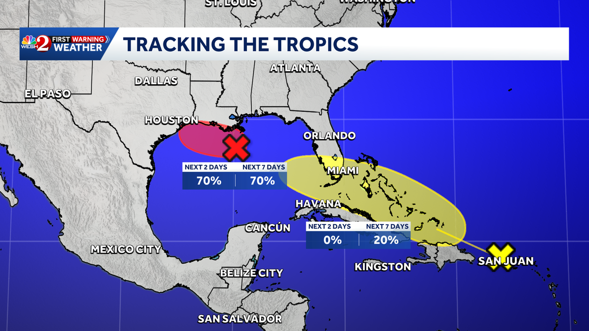
Invest 97-L is centered as a broad low-pressure area approximately 125 miles south of southeastern Louisiana, producing concentrated thunderstorm activity. NHC diagnostics assign the disturbance a 70 percent probability of tropical cyclogenesis within the next 48 hours, maintaining that 70 percent formation likelihood through the full seven-day outlook.
As the invest designation triggers specialized numerical modeling and high-density data gathering, the system is projected to drift slowly westward across the warm waters of the northern Gulf. Environmental factors remain conducive for structural consolidation into a tropical depression or tropical storm before potential landfall. Regardless of the exact degree of cyclonic intensification, the slow forward motion threatens low-lying coastal corridors in Texas and Louisiana with significant precipitation, posing acute inland drainage challenges for metropolitan areas such as Houston.
Remnants of Dolly: Caribbean Impacts and Downstream Potential
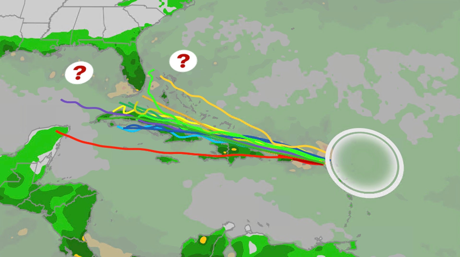
Concurrently, the remnants of Tropical Storm Dolly are tracking west-northwest at approximately 24 miles per hour east of Puerto Rico. Dolly originated on Thursday morning as the fourth named system of the 2026 season before deteriorating into an open tropical wave by late Friday morning due to the loss of a closed low-level circulation.
While immediate tropical redevelopment remains low during its rapid transit across the Leeward Islands, the Virgin Islands, and Puerto Rico, the wave continues to produce squalls, localized wind gusts, and heavy rainfall. In drought-affected sectors of the northeastern Caribbean, these precipitation totals offer crucial agricultural relief and reservoir replenishment without the destructive wind fields associated with mature cyclones.
Subsequent Meteorological Vectors and Naming Protocol
Extended trajectory modeling suggests the lifecycle of the Dolly wave could extend past the Greater Antilles. As the system moves toward the Bahamas and the Florida Peninsula, more favorable upper-level wind patterns and low vertical shear could enable structural reorganization.
Should either Invest 97-L in the Gulf of Mexico or the repurposed remnants of Dolly regain sustained tropical-storm-force thresholds, the systems will be assigned the next sequential designations on the 2026 Atlantic rotating list: Edouard and Fay. Emergency management agencies, maritime operators, and civil protection personnel across the Gulf Coast and Caribbean continue to align operational readiness with real-time NHC advisories.